- Tíðindi, mentan og ítróttur
New digital map of the Faroes
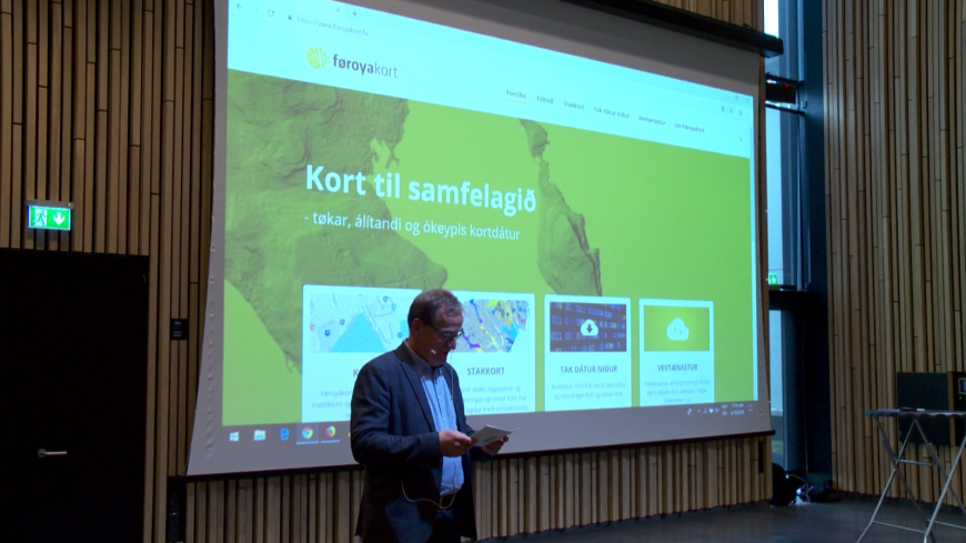
One of the country’s most popular websites, map site kortal.fo, has now been replaced with a more modern site, foroyakort.fo.
The new website, which is a partnership between the National Digitalisation Programme and the Environment Agency, features numerous new digital functions which were not available on the old site.
“There were too many technological obstacles behind the old site, so we decided to set up a brand new one,” says Petur Nielsen, CEO of the Environment Agency.
Endless possibilities
New features on foroyakort.fo include direct links to Google Street View, maps of charging stations across the islands, drone footage, old aerial views of the islands along with a wide range of downloadable data.
The new website also allows users to insert their own statistics and create their own digital maps, which allows for endless possibilities, according to Nielsen. Companies and individuals can also use the various data on the site to develop their own systems or apps.
“We have created an infrastructure which can be further developed by the users. This has proved very useful in the countries around us, as it adds value to the data and can easily create an economic ripple effect in our society.”
The text on the site is currently only in Faroese.
Translated by prosa.fo