Caption:
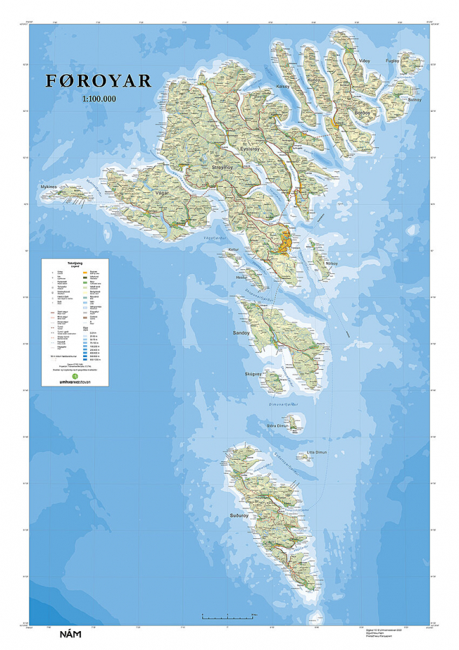
The map includes 1,700 place names and is available as a 120 x 80 cm poster
- Tíðindi, mentan og ítróttur

Schoolbook publisher Nám has published the first map of the Faroes to include 3D views of mountain heights and ocean depths.
Other new features include clear yellow outlines of residential areas green outlines for cultivated land. The map also has contour lines with 50-metre intervals to indicate ground elevation.
All these details are made visible through the latest UV digital printing technology.

The new map is available in print at Bókamiðsølan and for download here.
Read the Faroese version of this article here.
More Faroese News in English.